Polaris
Nuclear strikes from hidden, moving locations

Weapon Specifications
Note that the relationship between explosive power and destruction is not linear—a weapon’s destructive effects grow far more slowly than its explosive power.
Explosive Power
1.2 megatons
Hiroshima Equivalent Factor
80x
Dimensions
32 ft., 4 inches x 4 ft. 6 inches
Weight
35,700 lbs.
Range
2876 miles
Year(s)
1961–1996
Purpose
The first sub-launched nuclear missile
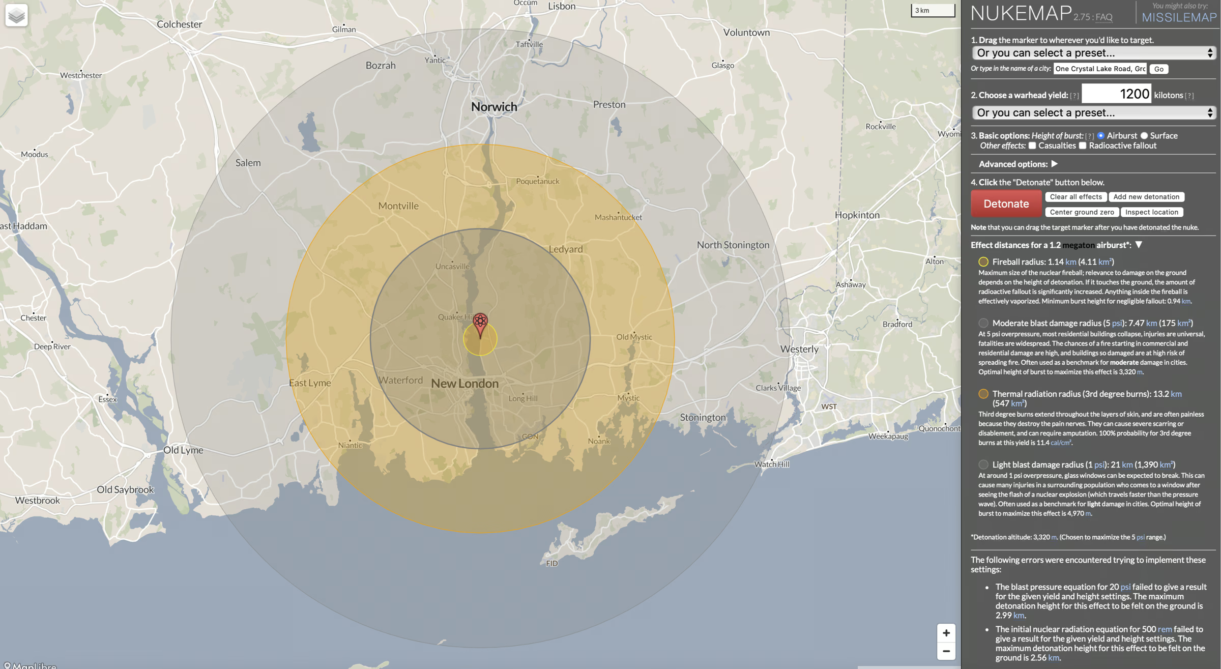
NukeMap
Simulated destruction of the Polaris missile at the Naval Submarine Base New London, Groton, Connecticut. Click on the map to change parameters.
Videos
These curated videos provide additional context for this weapon — showing test footage, deployment scenes, technical explanations, interviews, or other historical material, allowing viewers to go deeper into the weapon’s design, use, and place in nuclear history.
Further Reading
- Wikipedia, Misslery.info
- A good overview of the Polaris (at a page at Nuclear Companion that doesn’t seem reachable from the site’s main page). See also their page (with graphs) on Polaris’ deployment.
- For context, here is “A Brief History of U.S. Navy Fleet Ballistic Missiles and Submarines” from the Naval History and Heritage Command.
- A short overview of the Dahlgren Division of the Naval Surface Warfare Center, which did the software development for the missile’s guidance system, with a few personal reflections from the author, Robert V. Gates.
- Another good history of the missile from the US Naval Institute.
- The US Naval Institute has a short audio anecdote from a visit by Admiral Rayborn (head of the Navy’s Special Projects) to a Polaris component assembly line. (And click through to the extensive list of audio files from the Institute.)
- An overview with a listing of launches at Astronautix.
- A few thoughts on the early days of the Polaris programs and the changing definition of a successful test.
- The CIA has a copy of the New York Times’ obituary for Admiral William F. Raborn, a key figure in the development of the Polaris.
- The articles at the US Naval Institute are usually excellent. Here is a list of articles returned using the search term “Polaris.”